Frustrations... lack of progress... environmental groups are maddened but EPA is pleased...12/9/2018 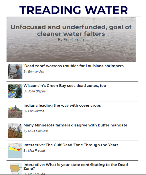 The Cedar Rapids Gazette has dedicated resources to reporting on the progress of the twelve states that have agreed to work toward a 45% reduction in the amount of nitrogen and phosphorus discharged to the Mississippi, with a goal of reducing the 'dead zone' in the gulf. This is an excellent series of articles, and is highly recommended to be read in their entirety. The Gazette keeps their content behind a pay wall, however, allowing only so many 'reads' for free, and then requiring subscription at the introductory rate of $.99 for the first month. Here's a link to the articles - well worth checking into. All that said, now here on the blog we will attempt to provide a summary - or maybe a teaser - with quotes and illustrations from the Cedar Rapids Gazette. The main article looks at what's being done and where, and how little progress is being made despite lots of sound and fury and expense. We also add here some information on what is happening in Minnesota, the headwaters state, where implementation is incremental at best, and positive results seen only on a small scale while the larger problem grows. The article starts off with a problem statement: "A government task force said in 2008 it would cut nitrate and phosphorus pollution 45 percent by 2015 — both to help the Gulf of Mexico, where the nutrients have created a sprawling dead zone in which wildlife cannot survive — and to protect the health and safety of Midwest waters. Now 10 years later, the dead zone is growing, the 45 percent goal has been shoved back 20 years and, although millions have been spent in nearly every state along the Mississippi River, it’s not clear any progress is being made, a four-month investigation by The Gazette found." There has been no reduction in nutrients, and the 'dead zone' continues to grow. Illustrations from the Cedar Rapids Gazette articles. “The Gulf’s oxygen-deprived dead zone, called that because fish and other organisms must swim away or die, has an average size over the past five summers of 5,772 square miles. That’s three times larger than the task force’s goal of about 1,900 square miles. The group established the 45-percent reduction in nitrate and phosphorus running into the Mississippi because that’s what scientists think is needed to shrink the dead zone. The task force’s 2008 Action Plan, a 64-page document that doesn’t describe enforcement options, asked each of the 12 central U.S. states to develop their own plans for reducing nutrients. The states are Minnesota, Wisconsin, Iowa, Illinois, Missouri, Indiana, Ohio, Kentucky, Tennessee, Mississippi, Arkansas and Louisiana. The Gazette reviewed all 12 state strategies, talked with dozens of state agency leaders and found the following:
In this article, Erin Jordan (author) contrasts the lack of progress in the Mississippi Basin with the work that is being done in the Chesapeake Bay, where reductions were mandatory and the water is getting cleaner. Click "Read More" below for more on Chesapeake Bay and information about voluntary and regulatory efforts to reduce nitrogen releases in Minnesota.
0 Comments
On December 3, 2018, LWV Upper Mississippi River Region held their bi-monthly Board meeting at the Coralville Public Library, in Johnson County, Iowa. The educational event after the Board meeting featured speakers from the Woman, Food and Agriculture Network, and the Izaak Walton League. These organizations, along with the LWV Upper Mississippi River Region, are reaching out to absentee landowners - people who rent farmland for others to farm.
Throughout the Midwest, absentee landownership of farm land is common. In some places, more than half the farmland is rented. The management of this land is critical - land owners must work with their renters to develop contracts that reward good stewardship and build soil health. How should these discussions be framed? How can the renter protect both the rented land and his bottom line? What will be the farming legacy of these rented lands? The Izaak Walton League (aka "the Ikes") received a grant from the McKnight Foundation and is developing workshops to provide landowners with this information. The LWV UMRR is working with the Ikes in our four-state area, with a goal of finding member Leagues to work with local Ike chapters put on these workshops throughout the watershed. The goal is to provide these landowners with tools and support to help them work with their renters to build soil health and improve the environmental performance of their farms. Here's the video from the presentation in Coralville. Our speakers, left to right, are Chris Henning from the Women Food and Agriculture Network, Mike Delaney from the Izaak Walton League and Lonni McCauley from the LWV Upper Mississippi River Region Inter League Organization.
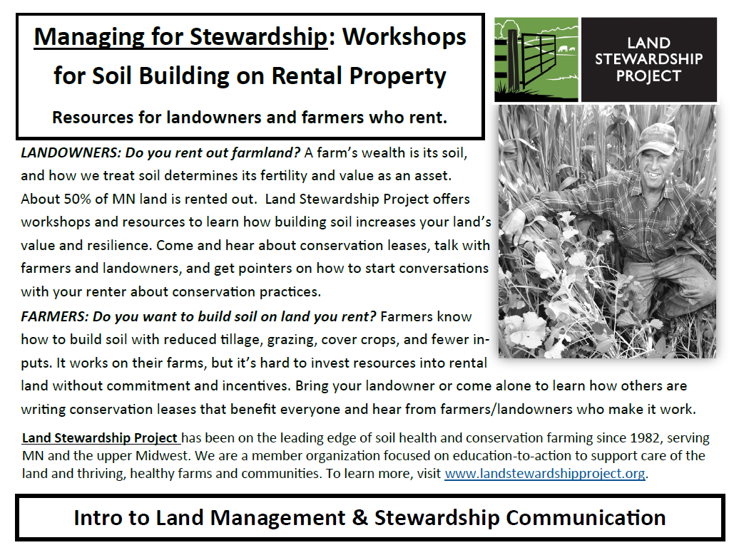
LWV UMRR is also working with the Land Stewardship Project in Minnesota. Here, a series of three meetings will occur in January, with follow up meetings planned for February. LWV'ers will be helping with these meetings, which will be be a good way to build LWV knowledge as well.
Changing practices and implementing pollution controls can be expensive. The benefits of these measures are broad, but the cost is often borne by a limited number of parties. How can this cost be shared across the watershed that benefits from the changes? The Great Lakes Commission is testing a market-based approach in the Western Lake Erie basin* – stewardship credits. “Many organizations and individuals are concerned about the health of Lake Erie. Harmful algal blooms have, in recent years, impacted local water supplies and upset the significant tourism economy. Stewardship credits are generated by agricultural producers who implement conservation practices to reduce the amount of nutrients (including phosphorus) leaving their fields and entering nearby waterways. The amount of nutrients reduced is translated into “credits” that can be purchased by “stewards.” Dollars invested in the purchase of stewardship credits pays for farmers’ efforts to reduce phosphorus contributions to waterways that flow into the Western Lake Erie Basin. Revenue from the sale of stewardship credits allows farmers to continue or increase those conservation efforts in the face of decreasing farm revenues. Stewards that buy credits can feel good knowing they are helping to improve water quality in Lake Erie.” source - Great Lakes Commission factsheet “How the Erie P Market Works for Stewardship” 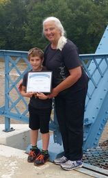 The market for stewardship credits is just opening - the first purchase by an individual was made by LWV Upper Mississippi River Region’s chair, Gretchen Sabel, for her grandson Isaac’s eight birthday. Isaac lives with his family in the Sandusky River Basin in northwest Ohio, and will benefit from cleaner water as he grows up. Of course, an organization purchasing a large block of credits would have a lot more impact than this single purchase. You can learn more on the Great Lakes Commission’s Lake Erie P Credits page here and purchase credits directly by clicking here. How do these stewardship credits work? This is a Credit Calculation Example Scenario that the Great Lakes Commission provides in the Framework for Water Quality Trading in the Western Lake Erie Basin (see full document here): “Farmer Brown lives in Defiance County, Ohio where he owns and operates a 100-acre corn and soy bean farm. After hearing about the newly introduced Erie P Market, Farmer Brown decides to improve his field management practices and make some extra money. Working with the local conservation district, he designs and implements a conservation plan that includes: (1) no-till (2) 4R nutrient management (3) the installation of a filter strip along the down-slope boundary of his property, and (4) planting 50-acres of cover crops. Using regional climate data, the results of his Mehlich 3 Phosphorus tests, and other detailed knowledge of his farm’s characteristics, Farmer Brown calculates his Credits to be traded on the Erie P Market as follows: 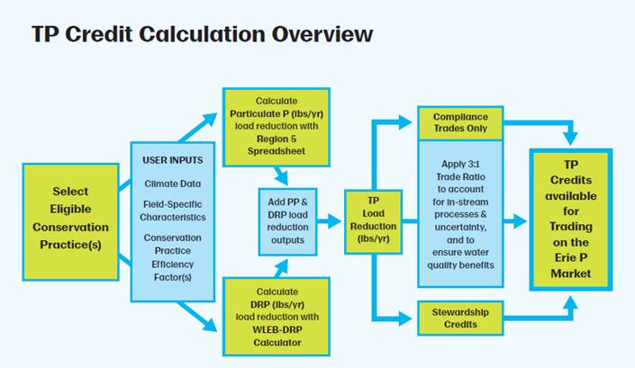 As you can see, the purchase of Lake Erie P Stewardship Credits helps farmers directly implement changes to reduce the loss of phosphorus from their fields. By increasing the pool of capital available to make changes, groups and individuals can help be part of the pollution solution! *Map of Western Lake Erie basin from Great Lakes Commission website: 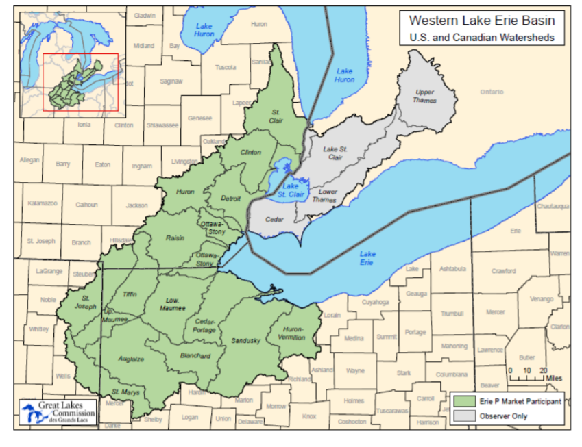
Never doubt that a small group of thoughtful, committed citizens can change the world; indeed, it's the only thing that ever has. - Margaret Mead
VIDEO OF THIS EVENT CAN BE SEEN HERE - many thanks to Bonnie and Beth for making the trek to Onalaska!
On October 1, LWV Upper Mississippi River Region will host a discussion with leaders from LWV Jo Daviess County. We will talk about what they have accomplished in the Galena River watershed, and what we, as community leaders, can do throughout the Upper Mississippi Watershed. The public is invited to join us - we will gather at the Upper Mississippi National Refuge Visitor Center at N 5727 Co Rd Z in Onalaska, Wisconsin (10 miles north of La Crosse) at 12:30 for light refreshments, the discussion will start at 1pm. Additionally, this post on the LWV UMRR blog has info on related events in the area. Here's a link to our Facebook event - feel free to share it!
Groundwater is a critical resource for Minnesota - it feeds our streams, fills our lakes and is a (mostly) clean and reliable source of drinking water for about 75% of the population. Many areas have localized problems, some with natural contaminants like arsenic, man-made toxics from unsound disposal of industrial wastes and many areas with nitrate contamination at levels that are of concern. Here's a link to a video from an LWV UMRR meeting last October where Chris Parthun from the Minnesota Department of Health describes the problems with nitrate contamination in our water. In 1989, the Minnesota Legislature passed a law aimed at increasing protection of Minnesota's groundwater resources. Click here to watch a video detailing Minnesota's 1989 Groundwater Protection Act. This act included a set of tiered actions to be taken to address everyday sources of groundwater contamination not addressed by programs like Superfund or the Leaking Underground Storage Tank program. This Act also established a groundwater protection goal of preventing degradation and reducing pollution where is has already occured. 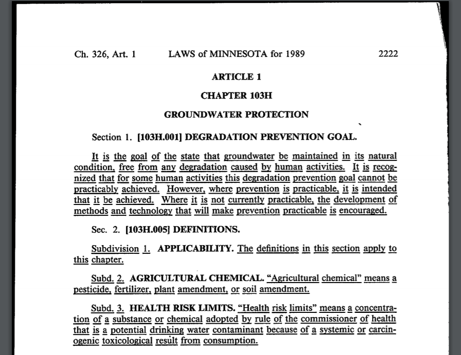 One area where groundwater protection is particularly thorny is in agricultural areas, where nitrate contamination is affecting both public and private wells, and the levels are rising. As laid out in the Groundwater Protection Act, the Minnesota Department of Agriculture is responsible for developing and administering programs and laws to address this. This has not been an easy course, and the twists and turns abound. This link leads to a blog post on the Loon Commons Blog by Matt Doll of the Minnesota Environmental Partnership. Here, Matt describes the rule that the Minnesota Department of Agriculture proposed to address the growing problem of nitrate in groundwater. The Minnesota Legislature introduced bills to stop this rule. LWV UMRR Chair Gretchen Sabel testified in both the House and Senate, on behalf of LWV Minnesota, in opposition to these bills. This link will take you to a copy of her testimony in the House. In the end, the bills were passed and Governor Dayton vetoed it. The Ag Committees in both houses have taken steps to use an administrative procedure to further slow the rule. Here's another blog post from Matt Doll on the topic. . The saga continues... the Minnesota Department of Agriculture is now in the process of finalizing the rule. Public comment will be taken until August 15 - read about it here. And comment! Clean water is important for all of us in the Upper Mississippi - Minnesota is the headwaters state, and this rule is just one part of the solution. 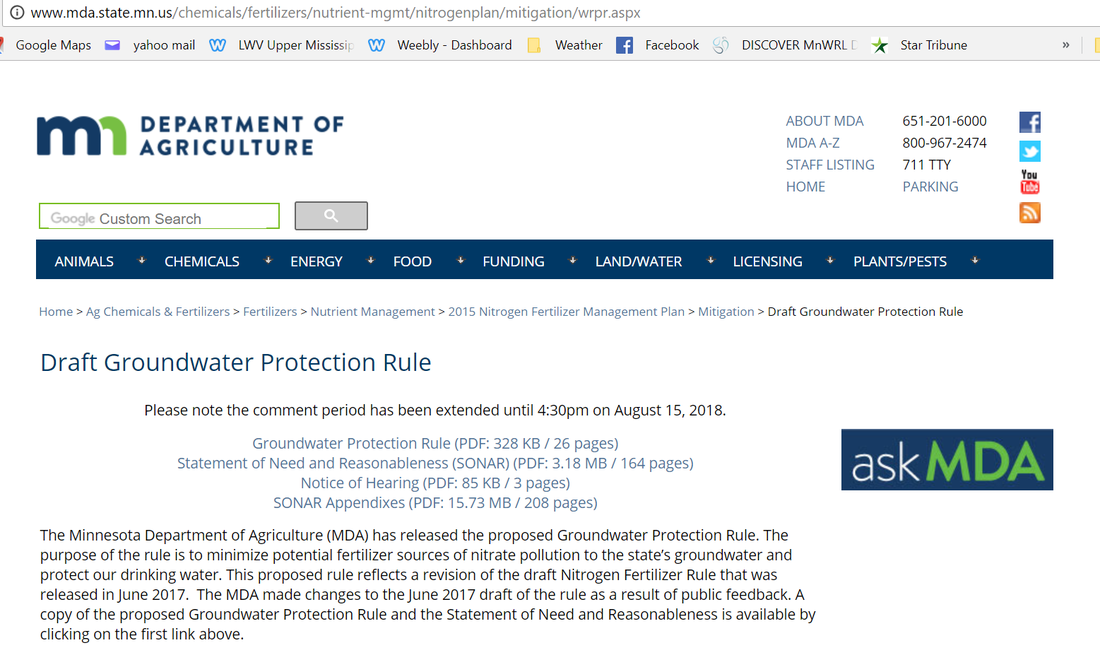 September 28 update - it looks like the 2014 farm bill expire - read more about it here on the National Sustainable Agriculture Coalition's very excellent blog update. We will have more on this site as events transpire... September 23 update - The 2014 farm bill's package of programs and funding expires in one week, on September 30. The 2018 farm bill moved ahead, with bills passing both houses of Congress this summer. Conference committee met in early September, you can watch the video here. But then, Hurricane Florence caused Congress to evacuate and delayed further work, so now things are really down to the wire. The bill on the Senate side does a good job of maintaining a strong conservation focus, but the House bill is not so good in this regard. This makes the work of the conference committee crucial. Now is a good time to contact your Representative in Congress and tell them that our country needs a farm bill that is strong on conservation and protects our water resources! THE FARM BILL IS A major legislative package that deals with U.S. Department of Agriculture programs ranging from food safety, trade, nutrition support and subsidies for farmers. Similar bills have been passed approximately every five years since 1933. The active version of the law, passed in 2014, expires on Sept. 30. (For more information on the content of the Farm Bill, read our blog post here.) 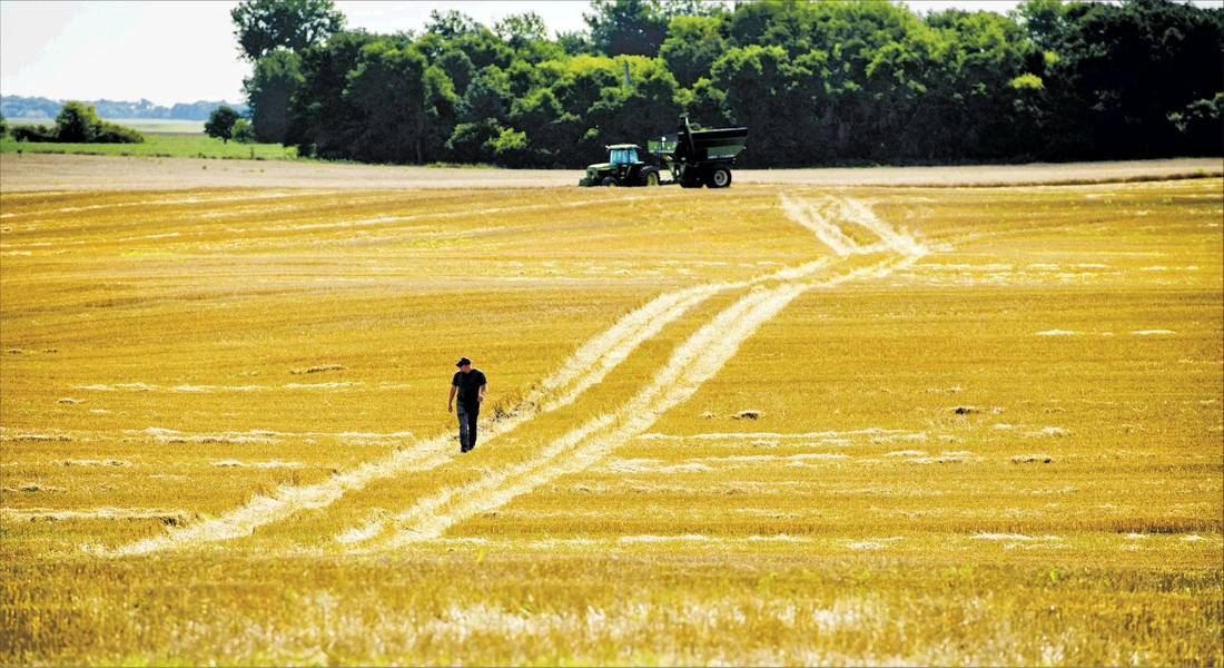 (Photo from Minneapolis Star Tribune Dec 17, 2017.
The 2018 Farm Bill is in the works. LWV UMRR is following this progress, and has signed on to letters urging Congress to improve the conservation titles in the Bill. This bill is at a pivotal stage now - read about it here on the National Sustainable Agriculture Coalition's blog. It's a good read, detailed and with clear explanations. Timing is critical - conference committee members have been assigned and it is expected that they will meet before the August recess, with a goal of getting a bill to the President for signature before the end of the Federal fiscal year on September 30. Algae stinks. It clogs up waterways and secretes toxins that are dangerous to humans and our pets. It’s also a vital part of ecosystems, a necessary base of the food chain. When nutrient pollution, particularly phosphorus, increases in a water body, excessive algae growth occurs, which results in stinky, dangerous problems. Algae blooms form dense mats on lakes, rivers and streams, affecting drinking water sources and water recreation. An 2014 algae bloom in Toledo, Ohio, (shown above) shut down their water supply, leaving the city of more than 400,000 people without water for several days. Circle of Blue, a website devoted to water issues, provides background information on toxic algae blooms. We wrote about that in this blog post in January 2017. Rivers and streams in Wisconsin are affected, too. At the LWV UMRR Annual Meeting in May, 2017, Kim Wright from Midwest Environmental Advocates talked about excessive algae that chokes the Red Cedar River in Menomonie –read about what she said and see the video of Kim’s presentation here. Thanks to the 2007 and 2016 “Pontoons and Politics” efforts of the Petenwell and Castle Rock Stewards an advocacy group in central Wisconsin, the Wisconsin Legislature appropriated funds for the Department of Natural Resources to develop a plan to address nutrient pollution, and the resulting algae blooms, on the river. This article from the Milwaukee Journal Sentinel provides more information on this work, as well as a video on the dangers of blue green algae. This plan is now open for public comment. It calls for a significant reduction of phosphorus to the Wisconsin River, to be achieved over time. The DNR website for this project provides copies of the plan and information on how to comment. This work is mandated by Clean Water Act provisions requiring states to list water bodies whose use is impaired by pollution, detail its sources and suggest limits on future pollution. 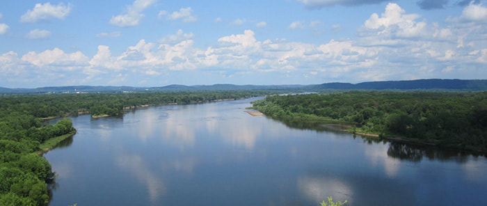 On January 20, 2018, people gathered in Boscobel, Wisconsin to talk and learn about the unique geology of the Driftless area,* and how this fragility requires extra protection. The main focus of this session was the advent of large animal feeding operations in the Driftless area and what these can mean to water resources. The sessions at this workshop were video'ed by Daniel Folkman, who has made them available to the public on his YouTube feed. Thanks, Daniel, for your work! Blog editor's note: This workshop was aimed at opposing the expansion of large animal agriculture in the Driftless area. The talks are not balanced by other viewpoints, and do not necessarily represent the views of LWV Upper Mississippi River Region. We present this here to share this information with our audience. The purpose of LWV Upper Mississippi River Region is to protect and enhance water quality in the Mississippi River, it's tributaries and groundwater in the watershed. We believe that ALL activities in the watershed should be protective of this precious resource. 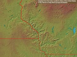 *The Driftless area is found where Minnesota, Wisconsin, Iowa and Illinois intersect. Here, deep valleys and steep slopes make the landscape dramatically different from other Midwestern vistas. This area was not covered by glaciers like the rest of the region, so the soil is much more shallow and bedrock is exposed in many areas. Water resources are abundant here, both surface and groundwater, but the shallow soil means that there is little protection for the water from land surface activities. The Mississippi River is the heart of this region, flowing from north to south. This Wikipedia reference provides a more detail on this region.
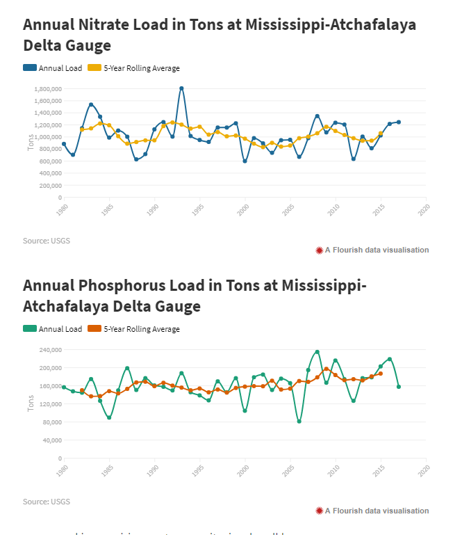
Choices journal focuses on water quality and ecosystem health in the Mississippi River Basin, with a keen eye on agricultural policy. Their December issue includes four papers presented at a recent conference that examine the political and institutional factors that have governed the design of conservation programs in the US, the design flaws that limit the effectiveness of these programs and the role that emerging technologies can play in leading to science-based conservation policy design. 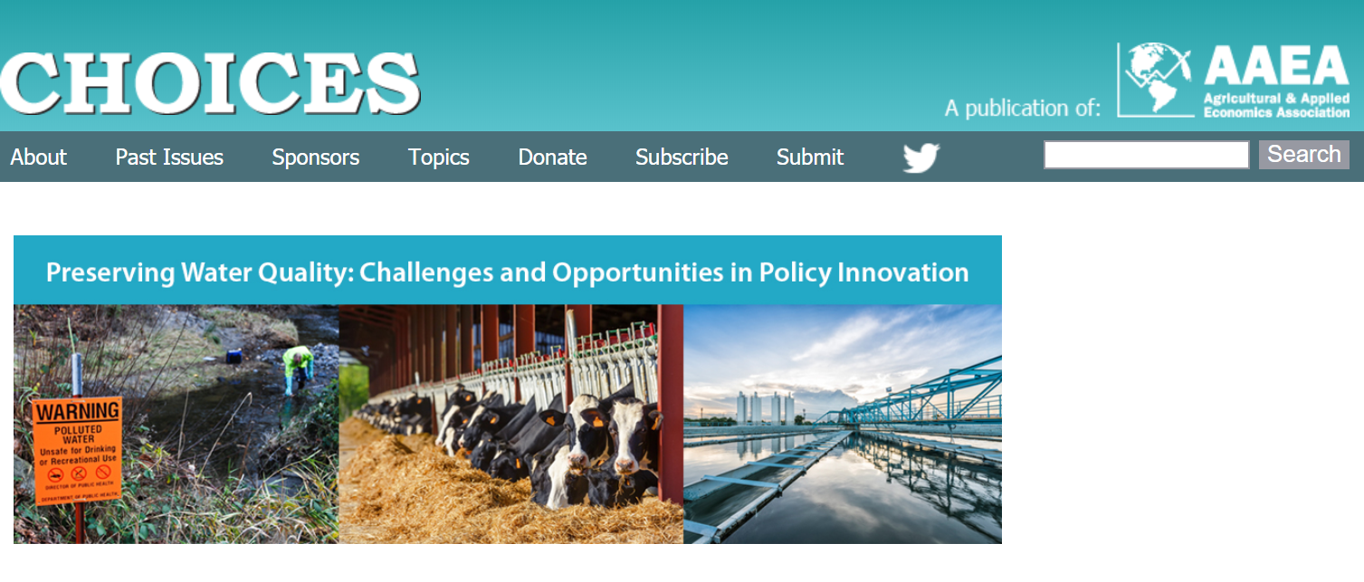 In his paper, Nexus between Food, Energy and Ecosystem Services in the Mississippi River Basin: Policy Implications and Challenges Madhu Khanna says, “One of the great challenges for the US Corn Belt is increasing the productivity of food and fuel production while reducing nutrient runoff, which is a key contributor to hypoxia in the Gulf of Mexico. The Mississippi–Atchafalya River Basin (MARB) drains about 41% of the conterminous United States and includes the Corn Belt, which is one of the most productive farming regions in the world. The hypoxic zone (Dead Zone) in the Gulf is the second largest in the world; in the summer of 2017 it was equal in size to the state of New Jersey, the largest extent ever recorded. Excess nutrient run-off generated by tillage and fertilizer-intensive agricultural and livestock production in the MARB is estimated to contribute about 80% of dissolved inorganic nitrogen (N) and more than 60% of delivered phosphorus (P) in the Gulf of Mexico (White et al., 2014). The U.S. Environmental Protection Agency (2007) estimates that a 45% reduction in both N and P loadings from the MARB relative to the 1980–1996 average annual level is needed to achieve desired reductions in the size of the hypoxic zone. Citing various sources, this paper makes the point that expanded agricultural use of the land not only impacts water quality but increases greenhouse gas emissions (due to loss of carbon storage) and reduces habitat needed for wildlife and pollinators, many of which are natural enemies of agricultural pests. Studies found that the expansion of corn production for ethanol has contributed to worsening the dead zone in the Gulf. Changing farming practices will be expensive, both in the cost of implementing new practices and in the loss of revenue to farmers. This paper cites analysis by Rabotyagov (2014), stating that the “lowest-cost strategy for achieving the hypoxia goal [reducing the dead zone in the Gulf] is estimated to cost approximately $2.7 billion per year in terms of lost profitability”. The upfront costs include obtaining equipment, machinery and establishing alternative perennial crops are considerable. 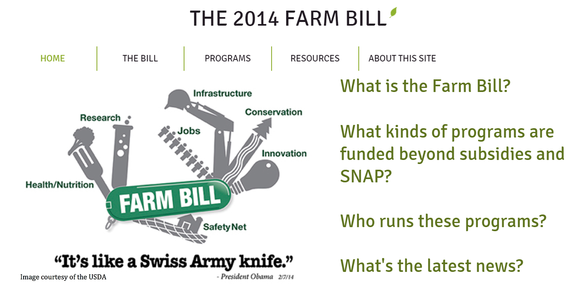 Click this graphic for detailed information on the 2014 Farm Bill, not part of Choices' articles. Click this graphic for detailed information on the 2014 Farm Bill, not part of Choices' articles. In CBO Baseline and the Potential for Conflicts by Expanding CRP, Jonathan Coppess looks at funding constraints in the coming Farm Bill. The Agriculture Act of 2014 (Federal Farm Bill) is the most important piece of legislation that affects farm and food policy in the US. Title 2 of this act includes eleven different programs aimed at conservation and water quality improvement, the largest of which are the Environmental Quality Improvement Program (EQIP), Conservation Stewardship Program (CSP), Regional Conservation Partners Program (RCPP), Agricultural Conservation Easement Program (ACEP), and Conservation Technology Assistance (CTA). Each program has a specific focus and target, and their coordination is not ideal. Expanding these programs, or adding new programs, will take funds from other programs under current budget disciplines being followed by the US Congress, so the stakes are high. South Dakota Senator John Thune, has proposed an alternative to traditional CRP enrollment.
“Called the Soil Health and Income Protection Program (SHIPP), his proposal would provide for short-term (3–5 years) reserved acres with a maximum of 15% of the cropland on a farm (Thune, 2017; S.499, 2017). The shorter contract period would make the program more responsive to market conditions. In addition, it permits some harvesting activities on the acres while under contract. From a baseline perspective, the proposal is designed to reduce the costs of enrolling acres. For one, it would limit rental payments to 50% of the average rental rate for the county. Senator Thune’s proposal has some historical precedent as well. Early farm bills used conservation rental payments to rent land out of production for a single crop year, but this policy was part of controversial efforts to control production through limiting acres.” In his article “Policy Reforms Needed for Better Water Quality and Lower Pollution Control Costs”, James Shortle points out inefficiencies in our current conservation programs. He “found that prioritizing practices based on their cost-effectiveness along with crude spatial targeting could reduce annualized costs of achieving required agricultural N, P load allocations across the [Chesapeake Bay] watershed state by 27% to 80%... “ He also advocates a fuller blending of approaches for managing point and nonpoint source pollution, specifically through a more robust trading program. Trading pollution credits allows for spending on practices that result in greater pollution reduction for less cost. The final article in this series is “Conservation Programs Can Accomplish More with Less by Improving Cost-Effectiveness” by Marc O. Ribaudo. One way that more can be accomplished with less is through performance-based payments, where actual reductions, rather than theoretical reductions based on changes in practices, are rewarded with payments. Ribaudo also encourages the use of community conservation principles. “Community conservation” engages all farmers in an impaired watershed to work on solutions in a group setting. Community recognition of environmental performance and the demonstration of innovativeness and entrepreneurship in managing a farm could increase conservation-oriented thinking on the part of those who were traditionally motivated primarily by profit. LWV UMRR and other groups providing outreach could have a role in this. Choices, the magazine of food, farms and resource use, is the principal outreach vehicle of the Agricultural & Applied Economics Association.  by Beth Baransky, Project Coordinator, LWV Jo Daviess County remote water quality sensing project
The U.S. EPA, in partnership with the Department of Agriculture, National Institute of Standards and Technology, United States Geological Survey, and the National Oceanic and Atmospheric Administration, put forth a challenge to submit proposals for the deployment of low-cost (less than $15,000) continuous nutrient sensors to address an important nutrient pollution water quality problem. The League of Women Voters of Jo Daviess County in Illinois (LWV-JDC) has been actively seeking water quality data for several years in order to increase our local knowledge. The ultimate goal is to achieve science-based stewardship of the water resources in our area. The Nutrient Sensor Action Challenge fit in well with the League's efforts. We submitted a proposal for the challenge describing the installation of two sensors, one each at the top and bottom of the Lower Galena River subwatershed to gather continuous data on nitrate levels in this portion of the river. Sam Panno, Senior Geochemist at the Illinois State Geological Survey; Walt Kelly, Groundwater Science Section Head at the Illinois State Water Survey; and Beth Baranski, Project Coordinator for the League of Women Voters of Jo Daviess County were the team members on the proposal. Having been selected as one of the winners of the challenge, in part because “The technical review panel determined that your submission could help better inform decision-making for nutrient reduction in our nation’s waterways,” the League will receive $10,000 in prize money. We’ve been told we can spend the prize money on a trip to Hawaii if we want, but - as tempting as that is - we’re thinking about how best to use the funds to advance water resource management work in the area. This prize money is being awarded for Stage 1 of the challenge, and consideration is now being given to competing in Stage 2 as well, which would involve actual sensor deployment. |
| LWV Upper Mississippi River Region | UMRR blog |

 RSS Feed