
What is a watershed?
According to the US Geologic Survey, a watershed is an area of land that drains all the streams and rainfall to a common outlet such as the outflow of a reservoir, mouth of a bay, or any point along a stream channel.
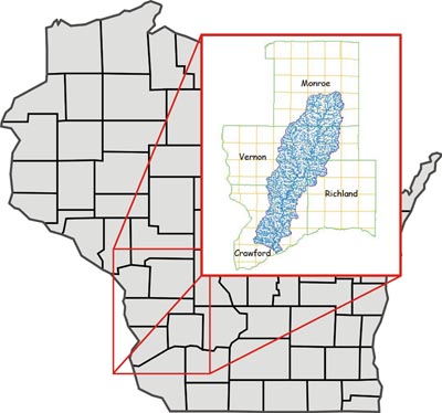
We all live in a watershed. This link can help you find yours. All watersheds are given a "HUC" or "hydrologic unit code", which is like a Zip Code that tells us where we are on the planet. All the watersheds in the Upper Mississippi River basin begin with the numbers "07". Watersheds for a large river feeding into the Mississippi, like the Wisconsin River, have four digits that identify their specific watershed. In this case the Wisconsin River is "0707" . Within that watershed, a small river will have four more digits - if you look at the the Kickapoo River is you will see that it is "07070006". This "eight-digit HUC" is key to beginning to understand your watershed!
We all live in a watershed. This link can help you find yours. All watersheds are given a "HUC" or "hydrologic unit code", which is like a Zip Code that tells us where we are on the planet. All the watersheds in the Upper Mississippi River basin begin with the numbers "07". Watersheds for a large river feeding into the Mississippi, like the Wisconsin River, have four digits that identify their specific watershed. In this case the Wisconsin River is "0707" . Within that watershed, a small river will have four more digits - if you look at the the Kickapoo River is you will see that it is "07070006". This "eight-digit HUC" is key to beginning to understand your watershed!
This works on a larger scale - the Mississippi River system reaches from the Rockies to the Appalachians, covering part or all of 31 states. The map below shows the full scope of the Mississippi River's reach! (map - US Geological Survey)

Did you know that the UMRR is not the only LWV ILO organized around a watershed? Check out the LWV Lake Michigan Region ILO, at http://www.lwvlmr.org/.